A POLICY & PLAN FRAMEWORK FOR NATURAL SURFACE TRAILS IN THE CITY OF ASHEVILLE, NORTH CAROLINA
Our Latest AVL Unpaved Update: March 13, 2026
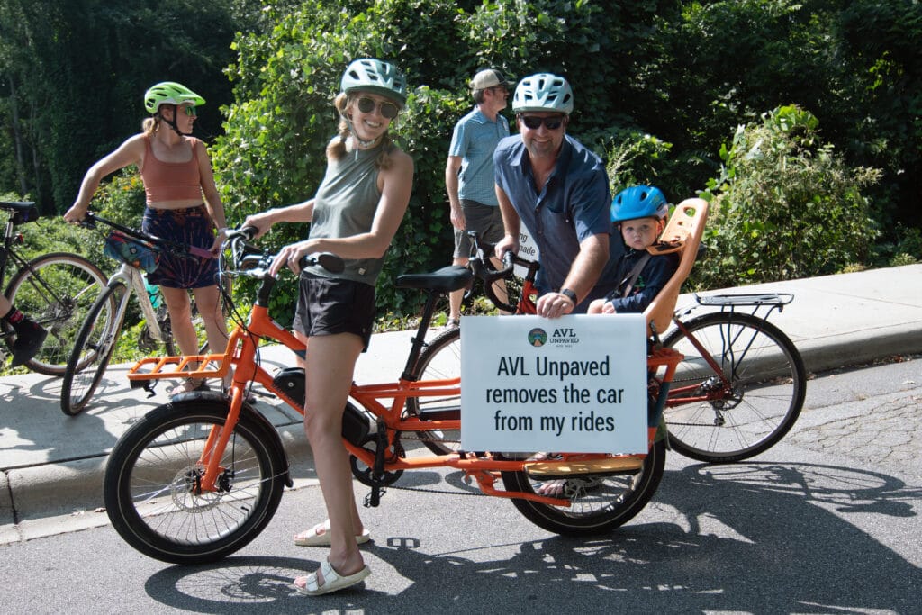
Natural surface trails near construction as the AVL Unpaved Alliance.
$5,000 Donor Match Challenge hosted by Baird: The Brookshire Garside Group
Support the AVL Unpaved project and double your impact before or at the Spring Out ‘26. All donations received on or before Sunday, March 29th count toward the donor challenge match.
Your donation today helps the AVL Unpaved Alliance bring these trails to life and manage the construction phase. Every dollar counts as we work to expand trail access in Asheville for mountain bikers, runners, hikers, families, and future generations.
Together, we’re building the trails Asheville deserves.
About the Trails
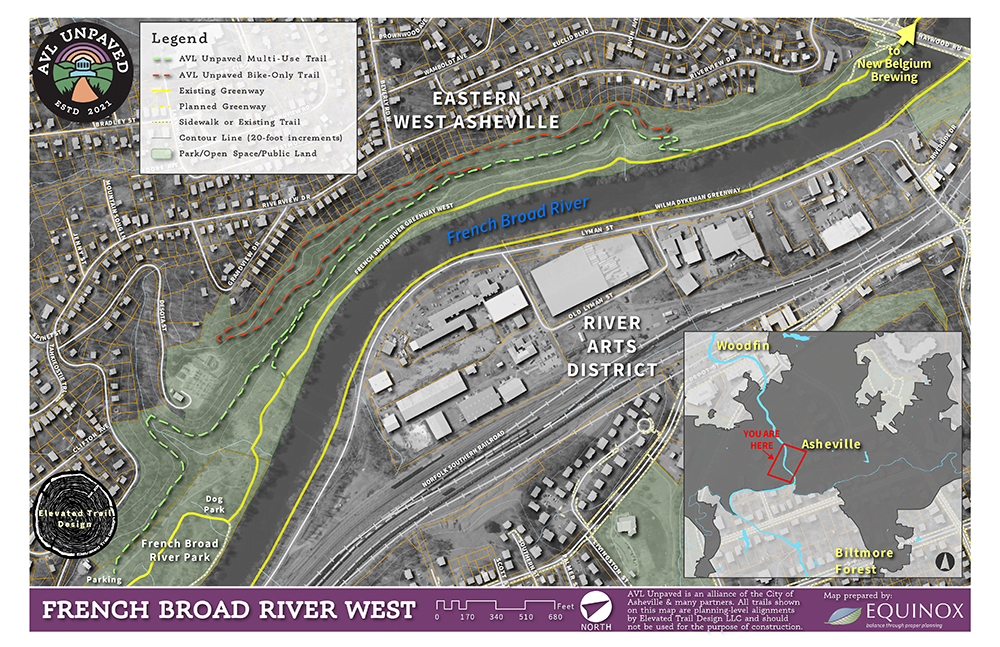
West Asheville Trail
These trails will sit beside the French Broad River West Greenway, and will be accessible by sidewalk, bike lanes, greenways, and transit.

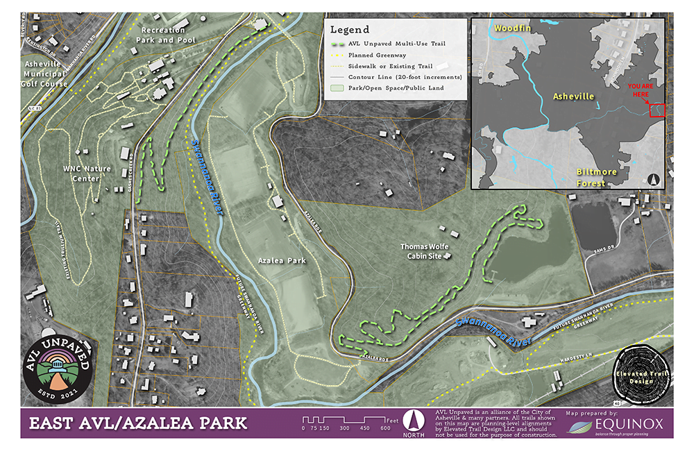
East Asheville Trail
This trail will expand the network around Azalea Park and eventually link to the future Swannanoa Greenway and the Hellbender Regional Trail, strengthening our region’s growing system of active transportation.

Progress like this doesn’t happen overnight—and it doesn’t happen alone. We’re proud of the work it took to get here, and we’re grateful for the city staff, community advocates, and local leaders who stood behind this effort.
Our region still faces challenges, but steady, meaningful wins like this one move us forward. Let’s take a moment to celebrate this progress.
AVL Unpaved Partners & the Vision
The AVL Unpaved Alliance—made up of nonprofit partners Pisgah Area Southern Off-Road Association, Connect Buncombe, and Asheville on Bikes—formed in 2021 to support the City of Asheville in creating a natural surface trail network. The goal is to provide greater access to Asheville’s green spaces and enhance active transportation by designing multi-use trails accessible via existing greenways, sidewalks, bike lanes, and transit.
“Removing barriers to outdoor participation is central to our work. By leveraging the strengths of our nonprofit partners, we can create Bent Creek–like experiences throughout our community so more people can easily access trails and greenspaces. These initial AVL Unpaved trails serve as a proof of concept for how Asheville can reimagine parks, recreation, and everyday mobility as we rebuild after Hurricane Helene.”— Mike Sule, Executive Director, Asheville on Bikes
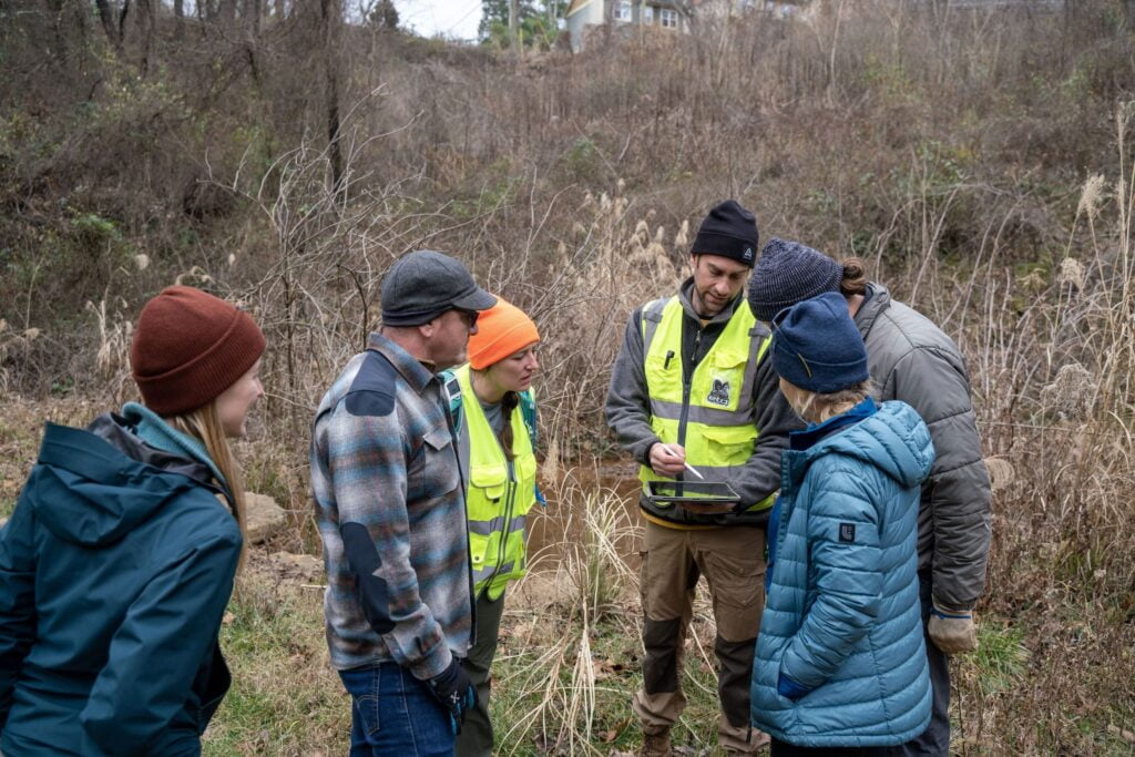
Five years after establishing the AVL Unpaved Alliance and a year and half following setbacks resulting from Hurricane Helene, the first trails are nearing construction. In July of 2025, Asheville City Council unanimously voted to support the AVL Unpaved initiative and in December of that same year, former City Manager Debra Cambell, just days before her retirement, codified the agreement between the AUA and the City of Asheville to allow trail construction to begin.
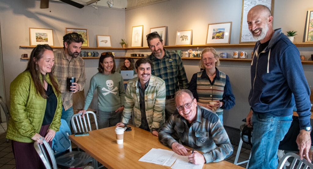
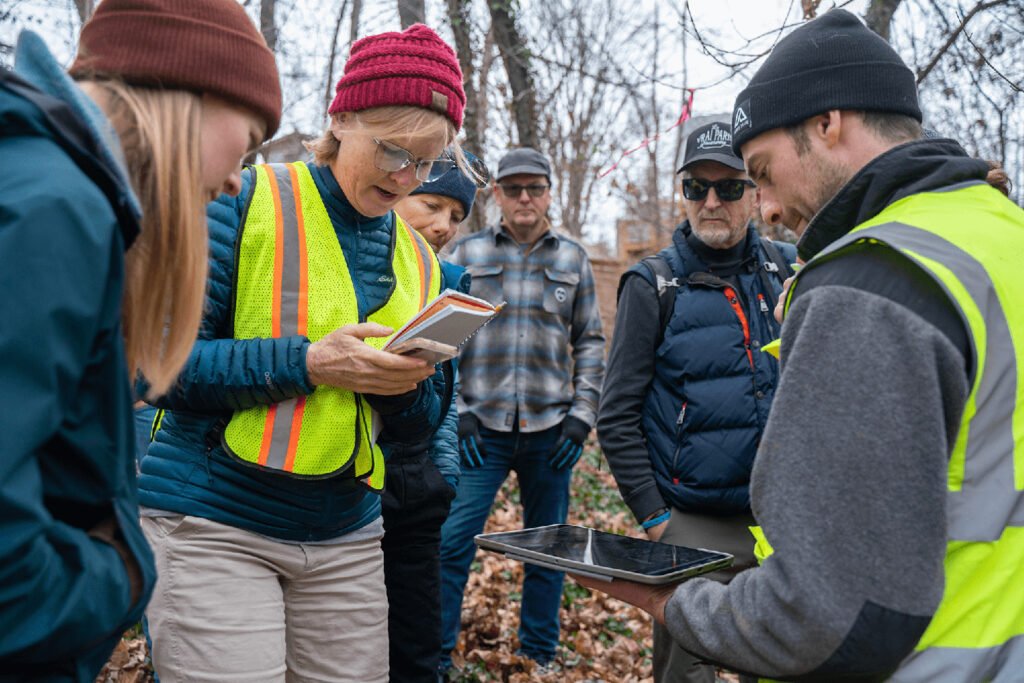
AVL Unpaved Alliance members and City of Asheville staff meet at Ultra Coffee in the River Arts District to sign the AVL Unpaved agreement.
Why AVL Unpaved Trails Matter
Expanding Access to the Outdoors
Everyone should have easy access to trails and greenspace. AVL Unpaved brings natural surface trails closer to where people live, making it easier for residents to walk, run, ride, and explore the outdoors without needing to travel across town to places like Bent Creek Experimental Forest.
Connecting Neighborhoods, Parks, and Places People Need to Go
AVL Unpaved trails link parks, wooded, neighborhoods, and local businesses into a growing network of accessible outdoor spaces. These trails create safe, convenient connections that let people move through Asheville’s landscape on foot or by bike—whether they’re heading to school, work, local shops, or a nearby park. By connecting people to both nature and the everyday places they need to reach, AVL Unpaved makes outdoor activity a practical, everyday part of life while strengthening community connections.
Supporting Healthy Communities
Access to nearby trails encourages physical activity, supports mental well-being, and gives people of all ages more opportunities to spend time outdoors. When trails are close to home, people are more likely to use them every day.
Building Affordable Outdoor Infrastructure
Natural surface trails can be built and maintained at a fraction of the cost of paved infrastructure. This allows communities to expand access to outdoor recreation quickly and efficiently while protecting natural landscapes.
Strengthening Community Stewardship
AVL Unpaved is built through partnerships between nonprofits, volunteers, and community members. This collaborative approach helps cultivate long-term stewardship and care for Asheville’s natural spaces.
A Proof of Concept for Asheville’s Future
The first AVL Unpaved trails represent a proof-of-concept investment—demonstrating how Asheville can reimagine parks, recreation, and everyday mobility as our community continues to rebuild following Hurricane Helene. By investing in neighborhood-scale trails today, we’re laying the foundation for a broader network that connects people to nature, essential destinations, and each other throughout the city.
How can I support AVL Unpaved?
As our community transitions into the recovery phase following Hurricane Helene, we have a unique opportunity to not only rebuild but also reshape our transportation and trail systems. Your donations will provide AoB with the resources needed to advance complete streets, expand multi-use trails, and develop the AVL Unpaved natural surface trail system.
Additionally, if you or your organization would like to support AVL Unpaved, consider making a tax-deductible donation. Every contribution brings us closer to a more resilient and connected community.
What are the AVL Unpaved Trails?
Asheville Unpaved is a plan to build natural surface multi-use trails within the City of Asheville on underused and undevelopable tracks of land. The goal is to increase each person’s access to trails and green spaces, without the use of a car. There is overwhelming research that reports the health benefits of proximity into greenspaces from the build environment:
- Growing Equity in City Green Space
- Better Forests Better Cities
- Lack of green spaces in under-represented communities is a health crisis that can’t wait
The AVL Unpaved Alliance (Alliance) is a group of nonprofits, made up of AoB, Pisgah Area Southern Off Road Organization (PASORBA) and Connect Buncombe, that formed in 2021 in order to promote this work. In partnership with the City of Asheville, the Alliance hired Elevated Trail Designs to design a proposal for a phase 1 series of natural surface trails in the undeveloped forested pockets of Asheville. Following Elevated Trail Design’s proposed system, the Alliance and City of Asheville presented the trail concepts to the Asheville community through a variety of public engagement events.
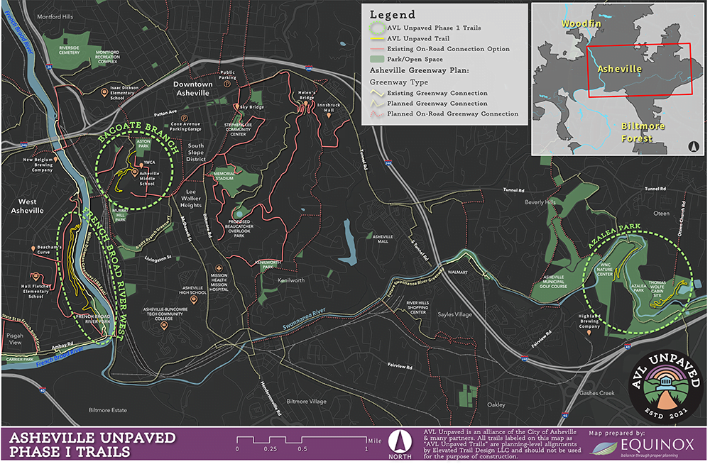
In 2022, thanks to generous community support and grant funding through Explore Asheville, initial projects were identified: French Broad River West and Azalea Park.
Explore the project maps:
What is the history of the project?
History of the Project
In 2021, three non-profit partners — Pisgah Area SORBA, Connect Buncombe, and Asheville on Bikes — began meeting informally to explore how they might support and advance city trails. Their shared vision was simple but powerful: make trails accessible within Asheville, from the door of your home, without a car.
The need was clear. Many Asheville residents drive to Bent Creek in Pisgah National Forest to hike, run, ride bikes, or splash in the creek. This “drive to hike/ride” pattern is bad for the environment, limits access for low-income residents, reduces the number of people who might otherwise exercise regularly, and contributes to overcrowding at popular trailheads. Asheville Unpaved was conceived to solve these problems.
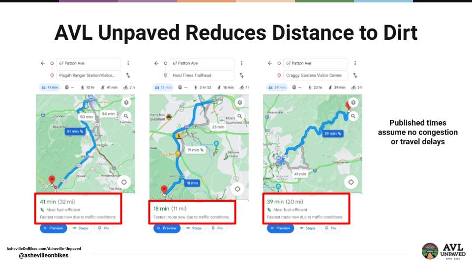
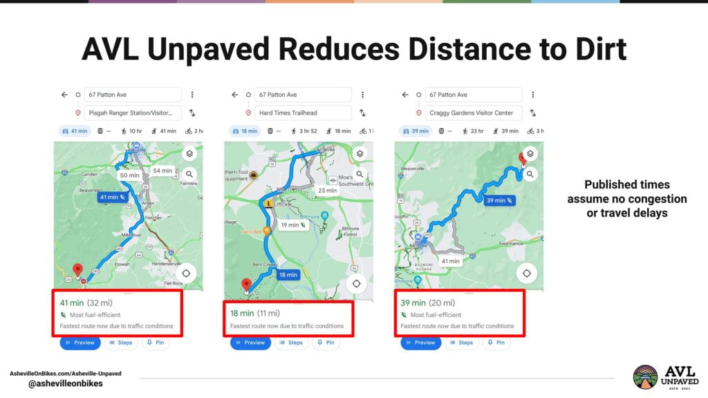
In October 2023, City Council unanimously adopted the Close the Gap Plan, which identifies natural surface trails as a key strategy for improving Asheville’s active transportation network — an approach the partners call “reducing your distance to dirt.” Complete streets, transit, and existing city parking all support access to these trails.
Then, on July 29, 2025, Asheville City Council took another unanimous vote — this time to formally support the AVL Unpaved initiative, authorizing the City Manager to enter into an agreement empowering the AVL Unpaved Alliance to begin building and maintaining two new natural surface trails within the city. It marked a defining milestone for trails, riders, and everyone who believes in expanding access to the outdoors.
Why is Asheville Unpaved Needed Now?
Asheville Unpaved is needed now because we should not keep building infrastructure that causes people to rely primarily on a car, that reserves our best outdoor experiences for our most privileged residents, and that makes it difficult to live a long life at full health within our City.
Western NC is a haven of outdoor activity and benefits from a large outdoor recreation industry. Statewide, outdoor recreation generates 14.6 billion in annual value for NC and accounts for 146,000 jobs. This trail system will help to grow that portion of our economy while also providing a direct local benefit to our residents. The AVL Unpaved system allows people to connect to the trail system via neighborhood streets. We call this improved access “front door access” and a “decreased distance to dirt.”
One of the lessons learned during the COVID-19 pandemic is that we are healthier when we have easy access to trails for exercise. As trail use spiked and visitors sought out Asheville as a safe haven during the pandemic, it highlighted the lack of trails in the City and also the many benefits of living in the mountains. The need for more trails in the Asheville area was made more apparent than before.
AVL Unpaved: Connecting People to Nature and Neighborhoods
AVL Unpaved Alliance is dedicated to building pilot natural surface trail systems that create better connections to Asheville’s natural environments for both residents and visitors. These trails are designed to be accessible via greenways, sidewalks, bike lanes, transit stops, and trailheads—bringing nature right to people’s front doors.
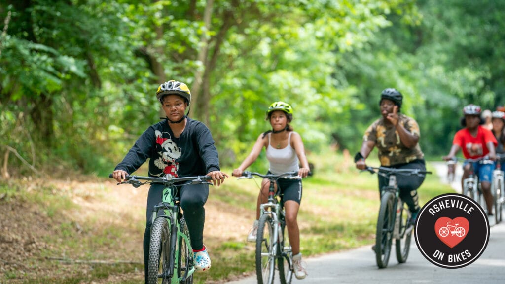
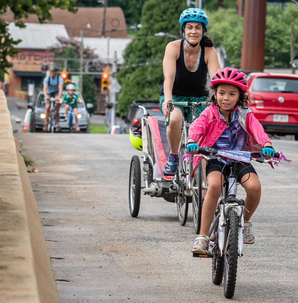
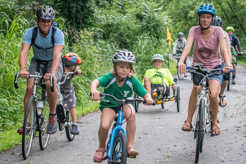
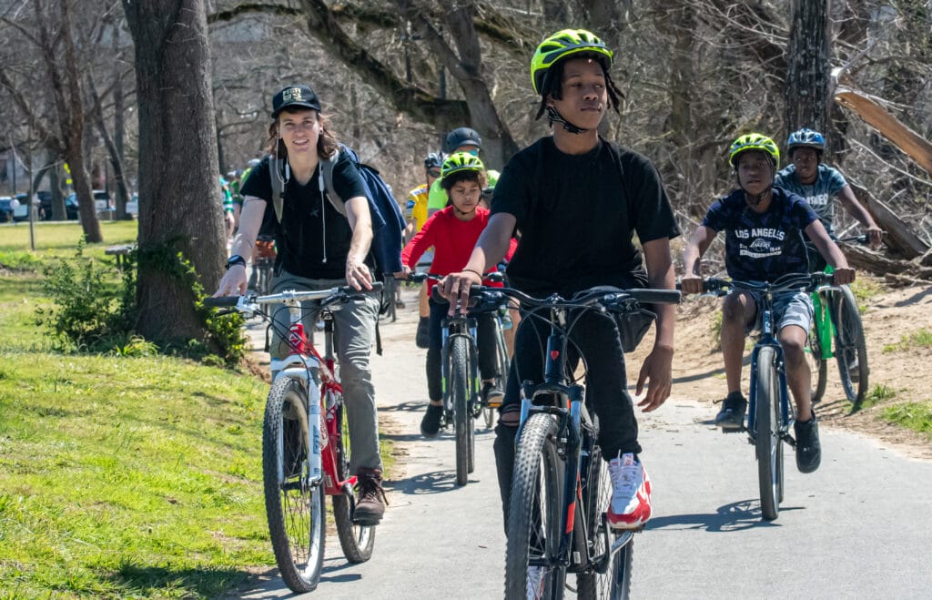
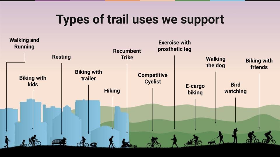
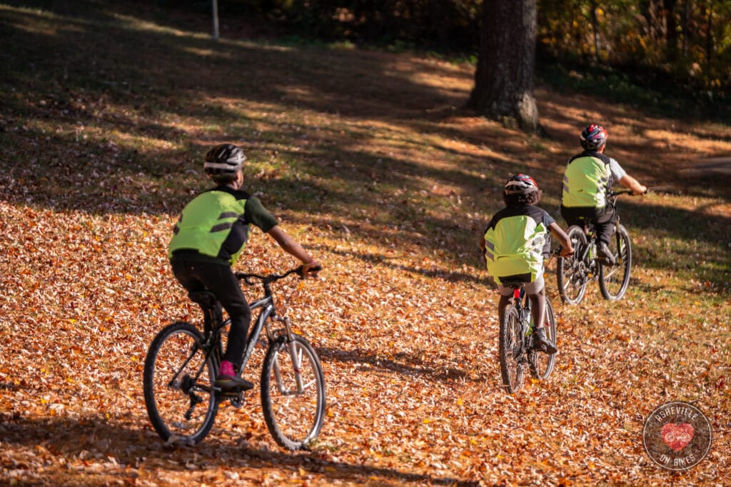
The AVL Unpaved network supports a wide variety of outdoor activities, including walking, running, biking with kids or friends, cargo biking, hiking, bird watching, and fitness for people of all abilities—from someone with a prosthetic limb to middle schoolers learning bike skills. Users can also enjoy quieter moments, like resting among the trees or exploring wooded natural areas. By providing safe, accessible routes and diverse experiences, AVL Unpaved makes outdoor recreation a part of everyday life while strengthening connections between neighborhoods, parks, and essential destinations.
What City of Asheville Resources Describe This Project?
- https://www.ashevillenc.gov/projects/avl-unpaved
- https://www.ashevillenc.gov/projects/close-the-gap-planning-process/
- https://www.ashevillenc.gov/projects/asheville-parks-recreation-comprehensive-plan/
- https://publicinput.com/fbrparks
- https://publicinput.com/azalearecovery
What news stories have been published about this project?
- July 31, 2025, The AVL Unpaved project rolls forward
- July 10, 2024 Asheville Unpaved learns from community pushback
- July 10, 2024 Government Accountability Project of Asheville
- June 12, 2024 Bacoate Branch Trail hits a dead end”
- October 27, 2002 Buncombe County TDA approves more than $9 million for 10 community projects
- April 8, 2021, Ashvegas, Asheville Unpaved initiative aims to create inner-city system of natural surface biking trails
- May 23, 2022, Citizen Times, See Asheville’s top 10 priority greenway projects, plan to fix ‘oatmeal cookie sidewalks’
- July 22, 2022, ABC13, Groups want to build network of natural surface trails in Asheville
- Oct 25, 2022, City of Asheville, City Adopts the Close the GAP plan
- Oct 26, 2022, Citizen Times, Muni Golf Course, city, county big winners in TDA funding grants
- Jan 3, 2024, Citizen Times, Answer Man: Unpaved trails to connect Asheville neighborhoods? When are they coming?
- Apr 30, 2024, AARP Western NC, Community Conversation: What is Asheville Unpaved?
- Jan 3, 2024, Citizen Times, Answer Man: Unpaved trails to connect Asheville neighborhoods? When are they coming?
- an 3, 2024, Citizen Times, Answer Man: Unpaved trails to connect Asheville neighborhoods? When are they coming?
- Oct 26, 2022, Citizen Times, Muni Golf Course, city, county big winners in TDA funding grants
- Oct 25, 2022, City of Asheville, City Adopts the Close the GAP plan
- July 22, 2022, ABC13, Groups want to build network of natural surface trails in Asheville
- surface biking trails
- May 23, 2022, Citizen Times, See Asheville’s top 10 priority greenway projects, plan to fix ‘oatmeal cookie sidewalks’
- April 8, 2021, Ashvegas, Asheville Unpaved initiative aims to create inner-city system of natural
- Dec 14, 2017, City of Asheville, Asheville’s Greenway Warmer was a hot event
Who is involved in the Asheville Unpaved Alliance?
Asheville Unpaved is a partnership led by Asheville on Bikes, Pisgah Area SORBA, and Connect Buncombe. This alliance has funded the AVL Unpaved’s phase I alignments and initial planning for the project. Future alliance partners are critical to AVL Unpaved’s success. This project requires work for trail planning, funding, design, construction, stewardship, and activation of use.
Who pays for these trails?
- The 3 trail alignments in Phase 1 are fully paid for by the community, thanks to support from individual donors and the Buncombe County TDA community grant program.
- The initial planning and design work has been paid for by the Alliance partners, who are Asheville on Bikes, Pisgah Area SORBA.
- The phase 1 trail construction plan is fully funded through individual donations and a TDA grant awarded on Jan 9, 2023.
Goals of the Asheville Unpaved Alliance
The Asheville Unpaved Alliance envisions the following goals for Asheville Unpaved:
- Trails serve as well-utilized transportation and recreation facilities. Trails serve the need of connecting neighborhoods, utilizing public space, and providing immediate access to quality trail experiences without the need of an automobile.
- Trails are built for sustainability. Trails built with proven construction techniques make them last longer with less maintenance. These same techniques make them more accessible to a broader population of people of varying abilities.
- Projects are equitable and meet the greatest need. Priority projects will benefit the greatest number of people and those most in need of trail access. The city-led public process will engage the public on trail projects on underutilized city-owned properties. Neighborhood groups or private landowners can work with the Asheville Unpaved Alliance to achieve shorter neighborhood trail connections.
Phase I: Proposed Projects
Phase 1 planning funders include the following Asheville-area non-profits: Connect Buncombe, Pisgah Area SORBA, and Asheville on Bikes. It also includes the
The following two connectivity maps show the phase one alignments and how they connect to each other via existing road networks and future planned greenways:
Trail Classes
Trail Hubs and Neighborhood Connectors are two classes of trail development that vary in purpose and method for implementation. The following is a description of these classes, their purpose, and characteristics:
TRAIL HUBS
- Purpose: To utilize public space for greater trail and recreation access on public lands. Hub trails can maximize use of space with “stacked” trail loops and can connect multiple destinations. The trail is designed to be the destination, may be more indirect, or have routes that serve as more direct transportation.
- Need: Hubs will take advantage of underutilized public space. Hubs can occur along greenway corridors either by building the trail adjacent to the planned greenway for a looped system or designing the trail to be an interim connection prior to the greenway being built.
- Partners: City, county, and/or state governments and Asheville Unpaved Task Force partners.
- Considerations: Design (level of difficulty and designing multi-use trails that reduce conflict), ADA requirements, MOUs needed, designing stacked looped systems, accessing multiple recreation destinations.
NEIGHBORHOOD CONNECTORS
- Purpose: To create neighborhood connections through private properties for quicker and more natural access. This provides an alternative route to get through neighborhoods. This may provide a shortcut, it might create a shorter connection (i.e. connecting two cul de sacs), it might just be nicer to walk in the woods than on the street.
- Need: Many neighborhoods in Asheville currently have community trails that are used to access through neighborhoods. This would allow for formalizing that access or to explore opportunities for new connectivity. The benefits would be less burden on the individual property owners via organized maintenance and freedom of liability in the chance of injury.
- Partners: Neighborhood organizations, private entities, city and/or county governments, Asheville Unpaved Task Force partners.
- Considerations: Design (level of difficulty), ADA* requirements, easements for public use, MOUs needed, funding opportunities.
The Asheville Unpaved Hubs and Neighborhood Connectors Map
The following maps indicate where hubs and neighborhood connectors are considered. Future trail projects are not limited to what is on this map, but should fall within the framework.
Provide Feedback
We welcome all input from members of the Asheville community. If you are an Asheville resident and you wish to provide feedback or suggestions for the Asheville Unpaved plan, please email ashevilleonbikes@gmail.com or fill out the contact form below.
Schedule a Presentation
AoB will happily participate in your upcoming meeting to present on AVL Unpaved. If you’d like for AVL Unpaved to be included in your upcoming agenda, fill out this form to schedule. We can do either in person or virtual.