This Thursday, March 28, the North Carolina Department of Transportation (NCDOT) hosts public comment regarding the Amboy & Meadow Roads widening project, STIP Number U-4739. The public meeting is hosted at Double Tree by Hilton Asheville – Biltmore (115 Hendersonville Rd) from 4PM to 7PM.
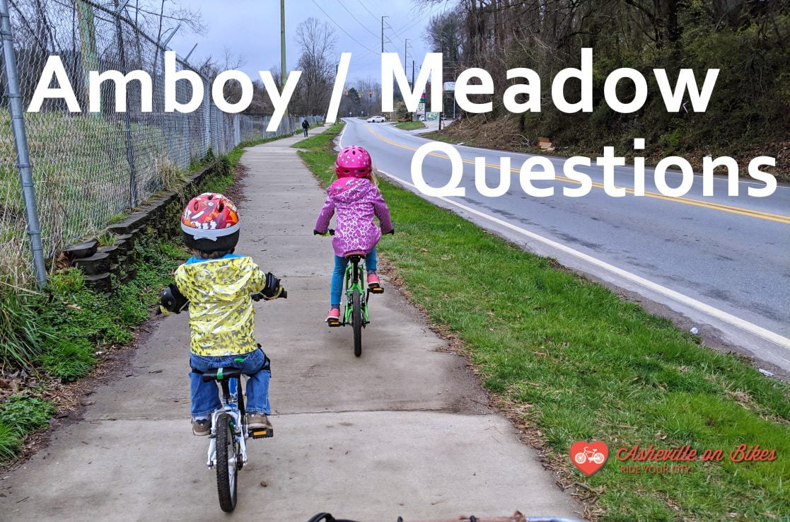
The Amboy & Meadow Road project will have a large impact on the future of Asheville’s active transportation network. AoB encourages you to participate in the drop-in sessions and follow the project closely.
A few notable items affected by this project:
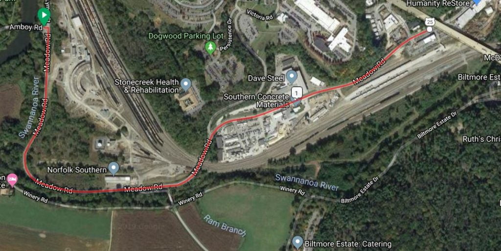
- Asheville and West Asheville’s connections (car/bike/ped) to Carrier Park and the Hominy Creek Greenway;
- The future Karen Cragnolin park design and other RiverLink work;
- The safety of bicyclists, pedestrians, and low speed vehicle users moving along or near Amboy Road and Meadow Road;
- The design of the on-bridge and intersection bicycle and pedestrian treatments where Amboy joins Lyman/Meadow, connecting the RADTIP greenway and on-street bike lane along Lyman to French Broad River Park;
- The design and routing of the greenway section that remains the missing link below RADTIP, the connecting greenway from Amboy Rd to Biltmore Avenue in Biltmore Village.

Here are some questions to ask at the meeting:
- How has NCDOT looked at population demographics related to income, race and disability status in the design of this project and linkages across it, especially with regard to access to the park and riverfront? What types of pedestrian and bicycling crossings will be incorporated into this project to provide safe crossing from West Asheville neighborhoods to adjacent parks? Are raised crosswalks or speed tables, curb extensions, and / or refuge islands being considered?
- How will NCDOT incorporate a “target speed” approach as identified in the AASHTO Green Book? What is the proposed design speed for this project? How was the design speed determined? Is the design speed determined or is it still being evaluated? What is the projected posted speed limit?
- What is the width of the vehicular travel lanes? Does the width exceed AASHTO guidance for a road of this classification?
- Are protected bicycle facilities included to separate bicyclists from moving vehicles? How does the current plan align with current FHWA guidance? (esp page 23) Does the plan align with FHWA guidance allowing flexibility for choosing standards for bike/ped facilities, which permits NCDOT to implement designs like the ones listed here: Designing for All Ages and Abilities (esp page 4), even without a formal adoption by NCDOT?
- What is the width of the proposed bicycle and pedestrian facilities? Do the widths align with AASHTO guidance?
- How has NCDOT’s Complete Street policy informed the design of this project?
- Will traffic calming facilities be incorporated into the project to maintain safe travel speeds for people walking and biking?
- How was pedestrian and bicyclist level of service (LOS) evaluated? What methodology was used? Is the evaluation published? (NCDOT Complete Streets Evaluation, p. 33)
- How will the design aim to incorporate trees to provide additional buffer (real and perceived) from cars? (As well as to provide the many other benefits from urban tree canopy?)
- How will the proposal connect to other city bike/ped infrastructure, especially where Meadow Road interacts with the proposed greenway as it approaches Biltmore Ave? (RADTIP/Wilma Dykeman RiverWay Plan/Swannanoa Greenway, especially the section between Amboy and Biltmore Ave)?
- How is NCDOT incorporating its Vision Zero policy into the engineering of this project?
See you on Thursday!