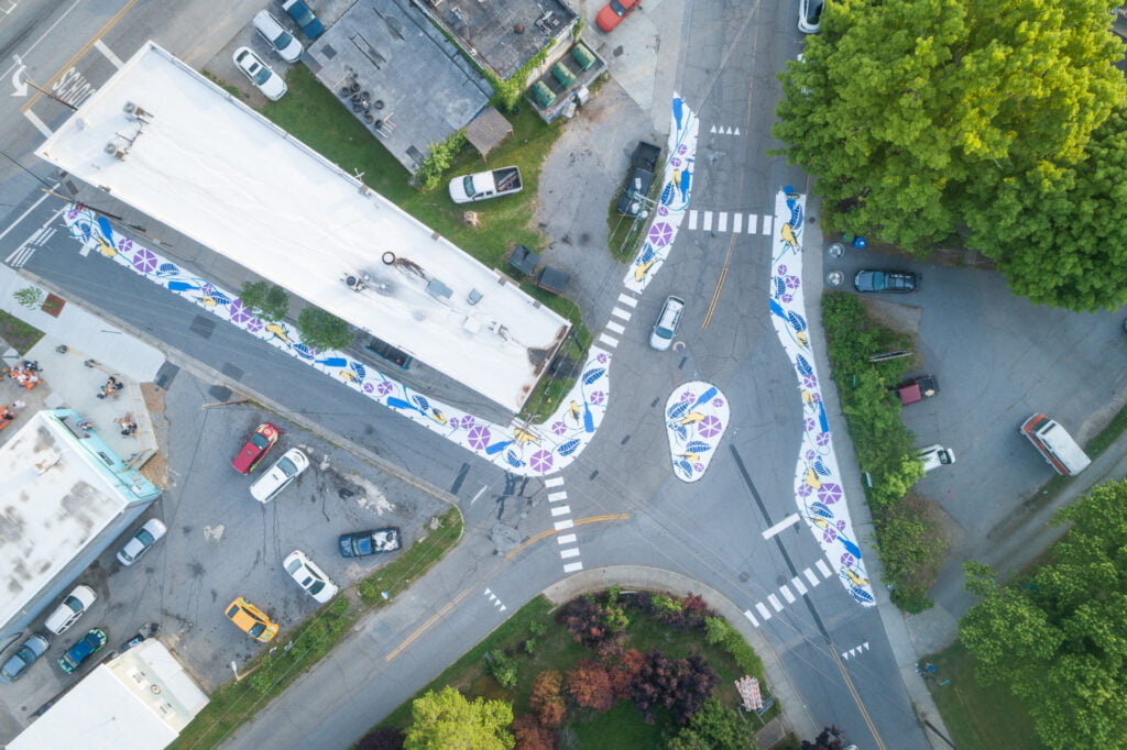
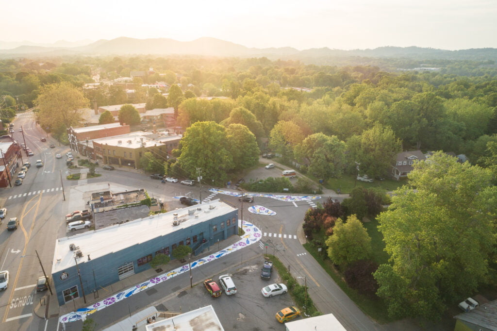
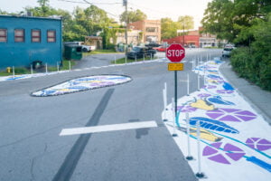
The Street Tweaks team installed a traffic circle, sidewalk extensions, cross walks, and other features at the intersection of Westwood Place and Waynesville Avenue May 20 through Saturday, May 23, 2021. This project is planned to last for a year and is part of our tactical urbanism work, intended to showcase a volunteer led “test – then build” process that can help our City move more quickly to safer streets accessible to all people.
The Street Tweaks Team appreciates volunteers, donors, The City of Asheville, the East West Asheville Neighborhood Association (EWANA), the West Asheville Business Association (WABA), and the corridor neighbors and businesses for their cooperation and support throughout the planning and installation phases of this project. Thank you! It’s a big team effort!
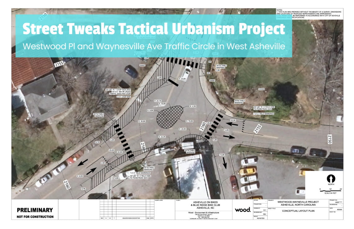
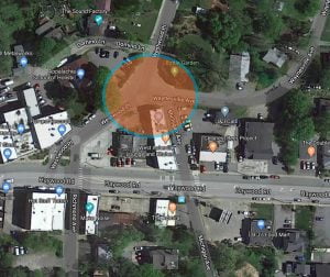
Google Maps link to this location. To see the finalized West Wayne build plan, click here.
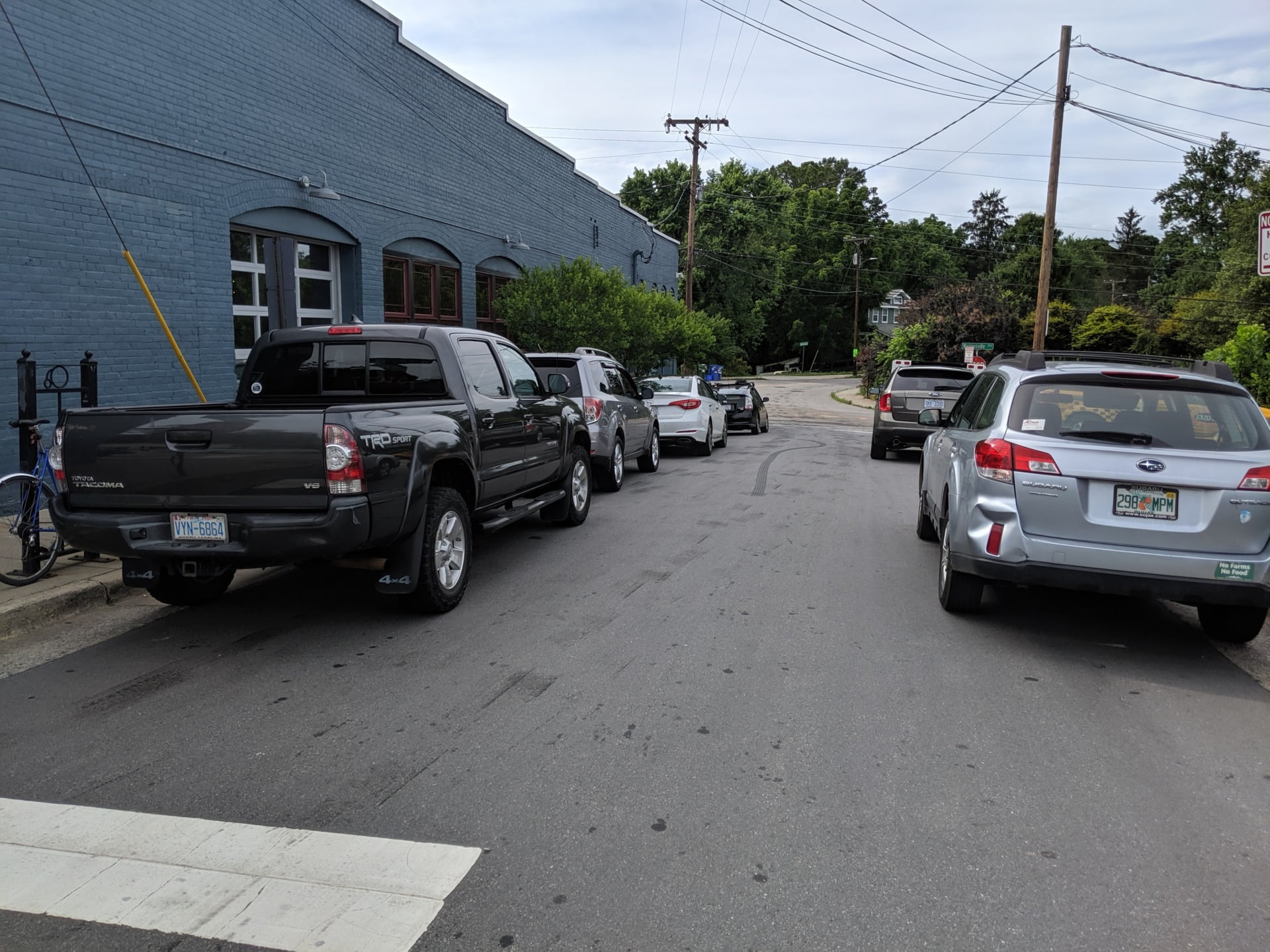
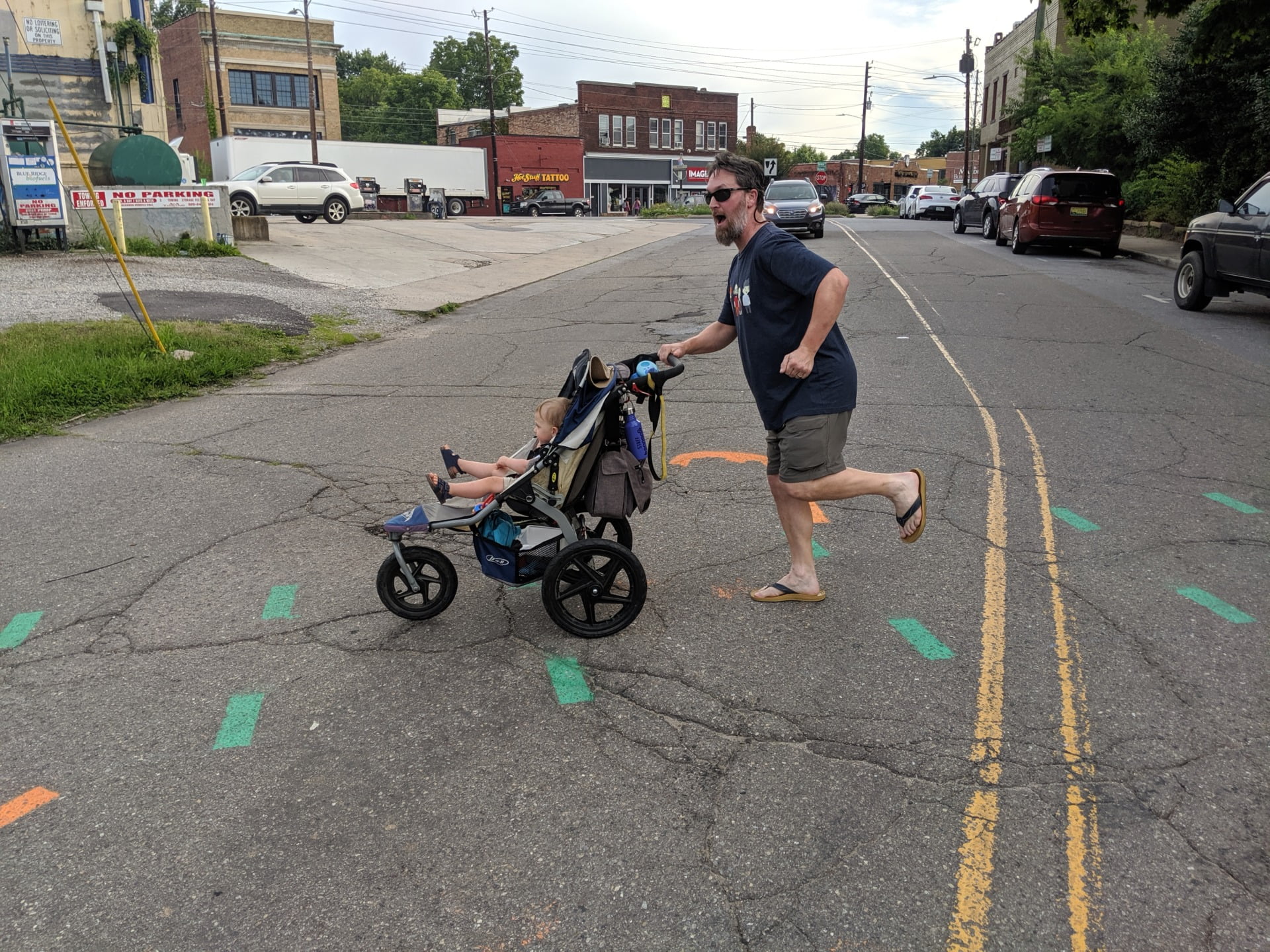
Photos of the installed project:
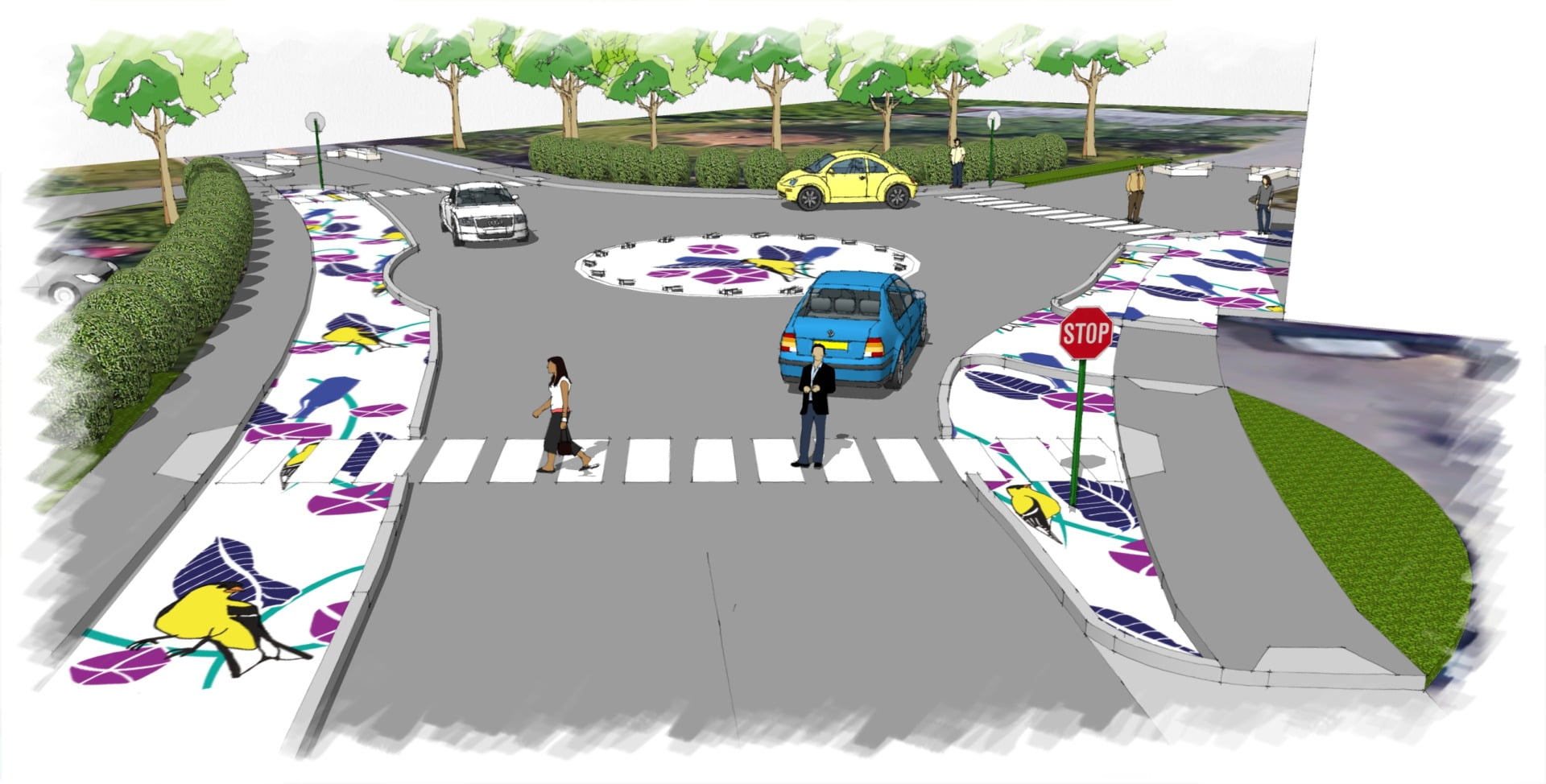
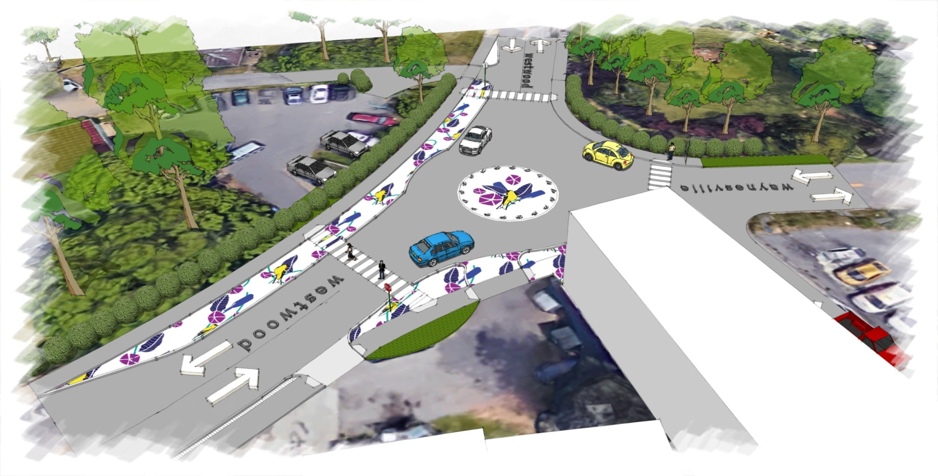
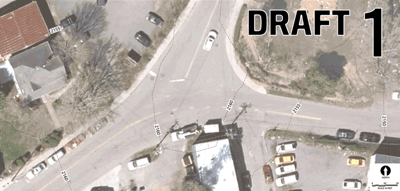
Renderings of the design:
About this project:
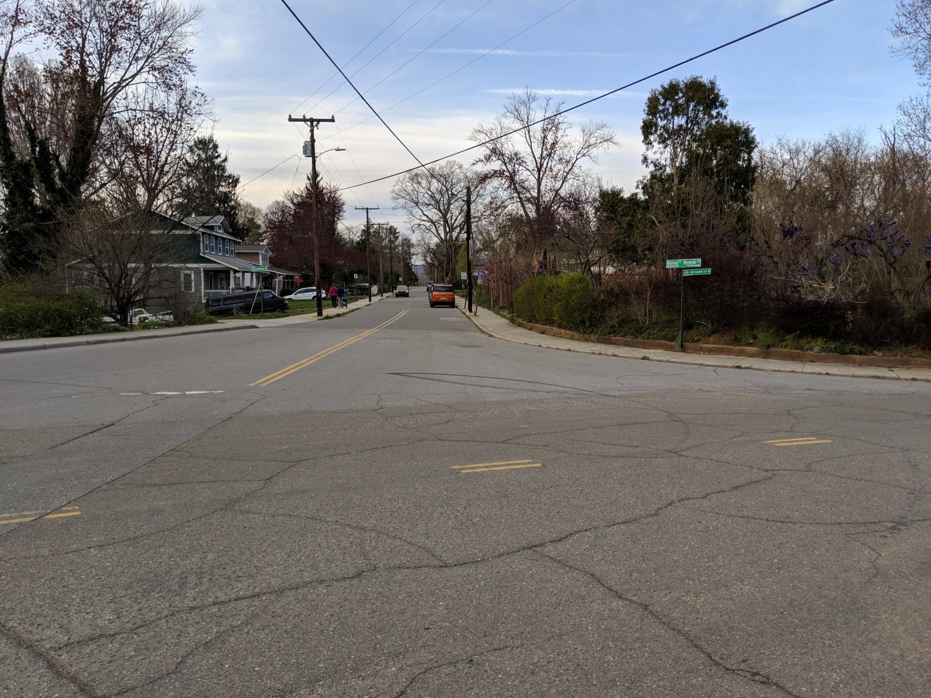
In Summer 2021 the Street Tweaks Team installed a tactical urbanism project at the intersection of Waynesville Avenue and Westwood Place, behind the Walk. This project is an intersection improvement consisting of a neighborhood traffic circle, crosswalks, and other related changes.
Why this location?
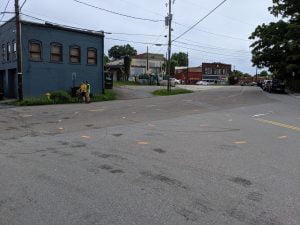
We identified this location when looking for intersections in walkable areas that highlight how dangerous our City is to pedestrians and bicycle riders. This intersection, as previously designed, allowed cars to turn at high speeds across the paths of pedestrians, bicycle riders, and other cars. Though a large number of people walk through the area each day, the street contained no crosswalks or safety markings (other than center lines). It was unnecessarily wide, increasing the danger to all who pass through the area. We approached the East Asheville Neighborhood Association (EWANA) and the West Asheville Business Association (WABA) to solicit support for the project. Each group responded favorably. That support and unsafe conditions led us to select this site for a test of a neighborhood traffic circle.
What are the details of the project as it exists so far?
Who is involved? The project was created and installed by the Street Tweaks Team with the help of neighborhood, WABA, and EWANA volunteers. It was approved by the City of Asheville before installation, including a signed Memorandum of Understanding (MOU) describing the project.
What is it? A neighborhood traffic circle, installed by volunteers, with City approval
Where? At the intersection of Westwood Place and Waynesville Ave in East West Asheville, behind the Walk.
When? Installed May 2021.
Why? To improve neighborhood and pedestrian safety
How? Using a tactical urbanism model, volunteers, and temporary materials, test a different intersection configuration
How long will it last? 1 year
What is tactical urbanism? Click here to find out.
Where are you in the process?
This project was built May 20th – 23rd, 2021.
Prior to installation, our team gathered public feedback about our designs. That feedback was used to settle on a final design and build plan. The technical constraints of the street at this intersection limit this project, in terms of types of infrastructure that can be built. Feedback from the City was essential so that we could present a design that met all the City’s requirements. The City approved our final design and the project complies with City of Asheville design requirements for this intersection.
Our first public meeting was held on Jun 26, 2019 to solicit feedback about this intersection. That meeting confirmed our findings about people who were walking between the neighborhood and the businesses and schools nearby. During the winter of 2019, we worked on proposed designs with the City of Asheville.
Our second public meeting was held on March 8th, 2020. A tent staffed by volunteers was set up at the intersections and we answered questions, showed designs, and walked the intersection with attendees.
Our rolling survey for feedback, a third round of public input, happened during late May and early June 2020.
This project received approval from the Multi-Modal Transit Committee and the City Manager’s office and a signed Memorandum of Understanding between the Street Tweaks team and the City of Asheville (MOU) describes the project. Designs were also presented in advance to adjoining property owners, WABA, and EWANA, and were posted at the intersection for a year prior to installation.
Learn more about the resident artist of this project, Leslie Rosenberg:
How did we come up with the design?:
This design was the result of public input that inquired about people’s visceral experiences while on the project site. Artist Leslie Rosenberg compiled and sifted through the public input and was inspired to create the current design which, as Rosenberg shares, “Christopher’s Garden, which formerly occupied this intersection, holds a special place in people’s hearts. Christopher’s blue bottle trees and the flora and fauna that seem to overflow onto the sidewalks in this intersection were reoccurring input themes. The goldfinch and milkweed along with the blue bottles seemed an apt snapshot of the intersection, giving the work both a place-based context and a sense of community collaboration.”
 Leslie Rosenberg is a Citizen-Artist and catalyst for collective creativity. Having taught K-12 visual art, adventure therapy to at-risk teens, and currently, a shop manager at UNCA’s STEAM Studio makers’ space, Leslie considers herself both a teacher and student of experience. She is most excited about work that brings together disparate groups towards a common goal of beauty, connection, meaning, and justice. Her work with Art of Belonging takes the discipline of visual art and design and uses it to affect collective change.
Evolution of our design
Our designs for this project evolved as we worked with City staff and our team to come up with a plan that will meet all existing regulations, is likely to be an improvement from existing conditions, and that we can install with temporary materials. This graphic shows the process:
How dangerous is Asheville?
We continue to rank among the most dangerous cities in North Carolina for pedestrians and bicyclists. In January 2020 alone, 4 pedestrians were killed in different crashes across the City.
Asheville is first in pedestrian deaths per capita in North Carolina, as written up in an excellent article from the Citizen-Times on 3/4/2020.
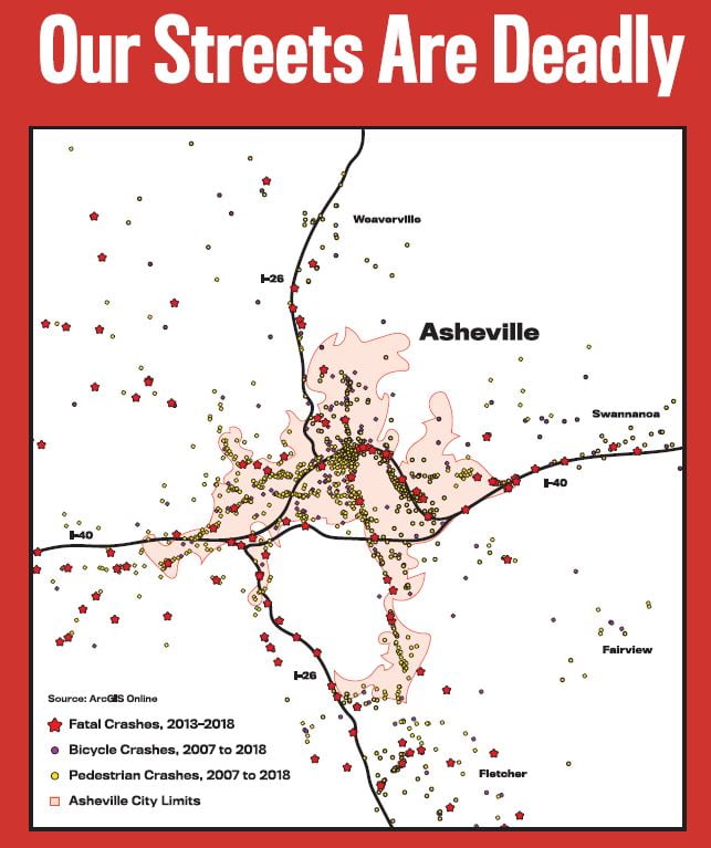  |
Want to dive deeper? Spend a few minutes looking over the map of fatalities (all collisions) and bicycle pedestrian injuries (bike/ped) for our area, built with publicly available NCDOT data. Keep in mind that bicycle/pedestrian injuries, when studied nationwide, are often under-reported. This happens because our method of reporting emphasizes collisions with severe injuries that involved a motor vehicle. Lesser injuries and collisions with no EMS response often go unreported.
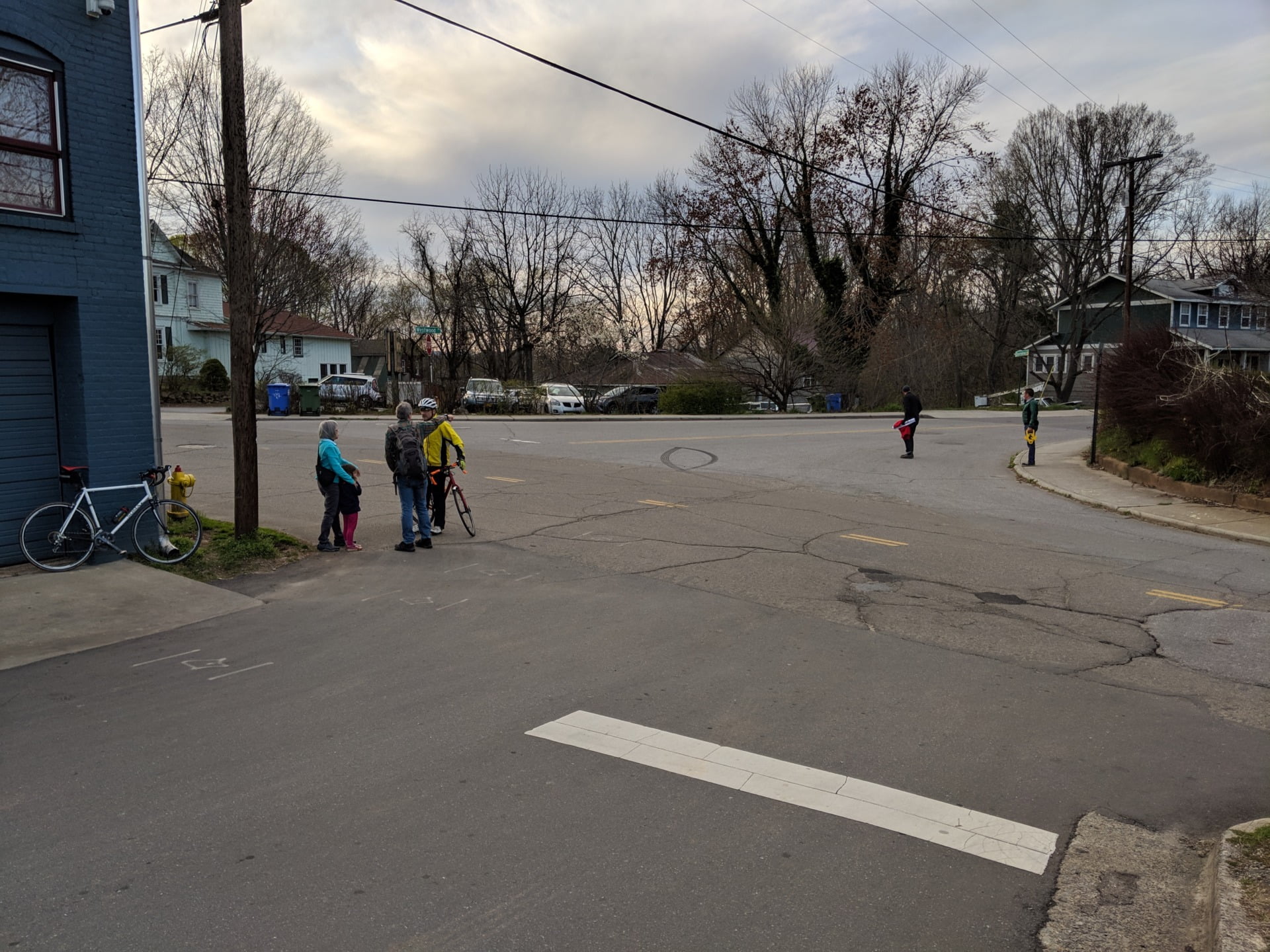
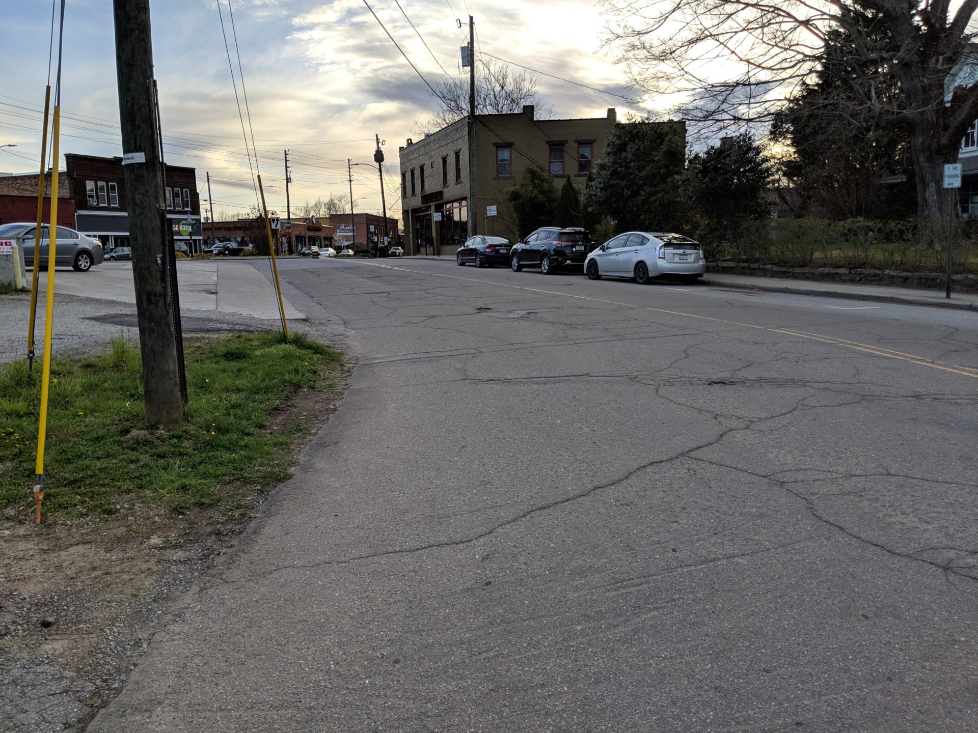
Photos from this project during the planning phase:

Special thanks to:
-
-
- Art of Belonging, Leslie Rosenberg
- Wood Environment and Infrastructure, Tony Hauser
- Fusco Landplanning & Design, Matt Fusco
- Insite Collaborative, Craig Ruhland, PAS President
- East West Asheville Neighborhood Association
- West Asheville Business Association
-
Partially funded by grants from:
-
-
- People for Bikes
- Blue Ridge Bicycle Club
- AARP, NC, Mountain Region
-
Project downloads and key links:
- A coloring book of 3-d renderings (pdf)
- Project design file (not a final design, pdf)